![]()
![]()

![]()
The state of Maine is accepting map images. If you would like to be part of the Digital Map Library team and/or make contributions, please e-mail Rebecca Maloney. Your contributions are both needed and appreciated!
Maine State Maps
Maine County Maps
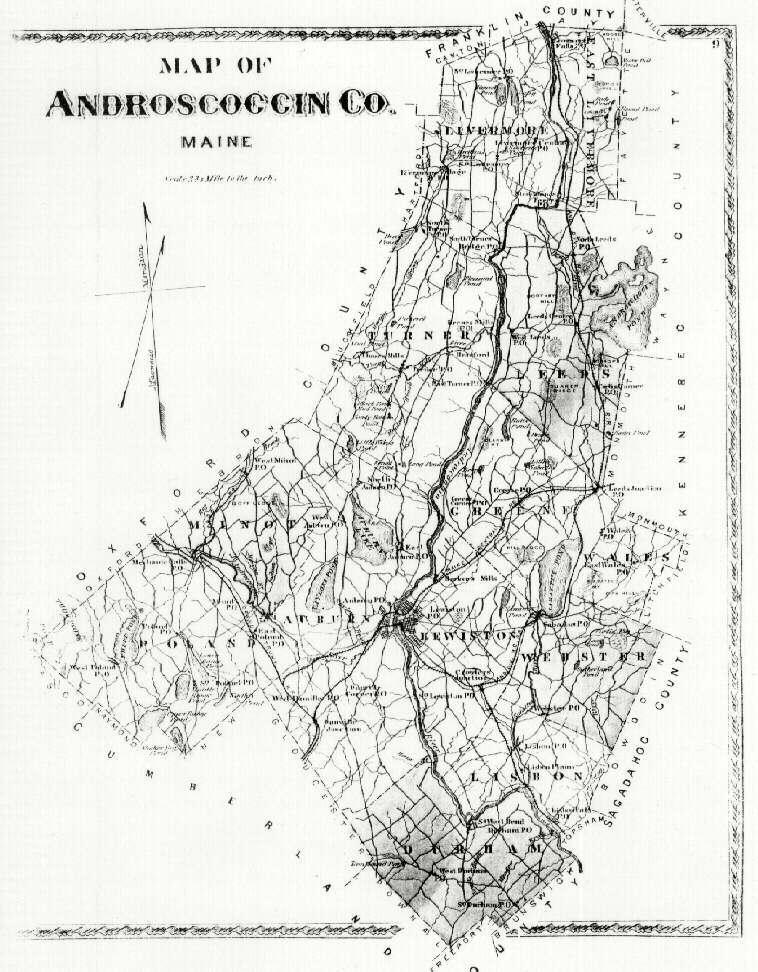
- Androscoggin County, 1873
- Androscoggin County (758 K)
- Cumberland County, 1871 (size 470 K)
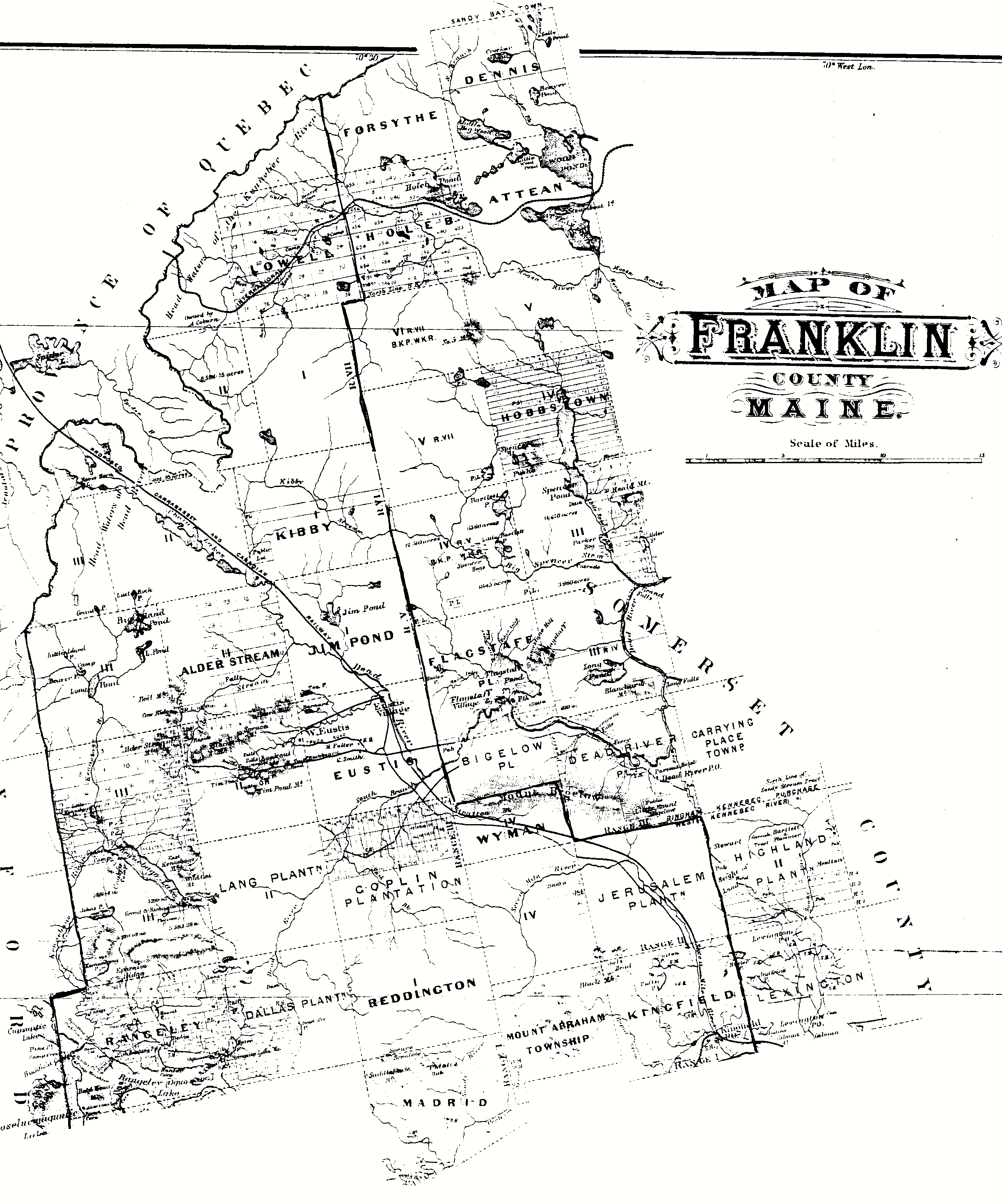
- Franklin County (part 1)
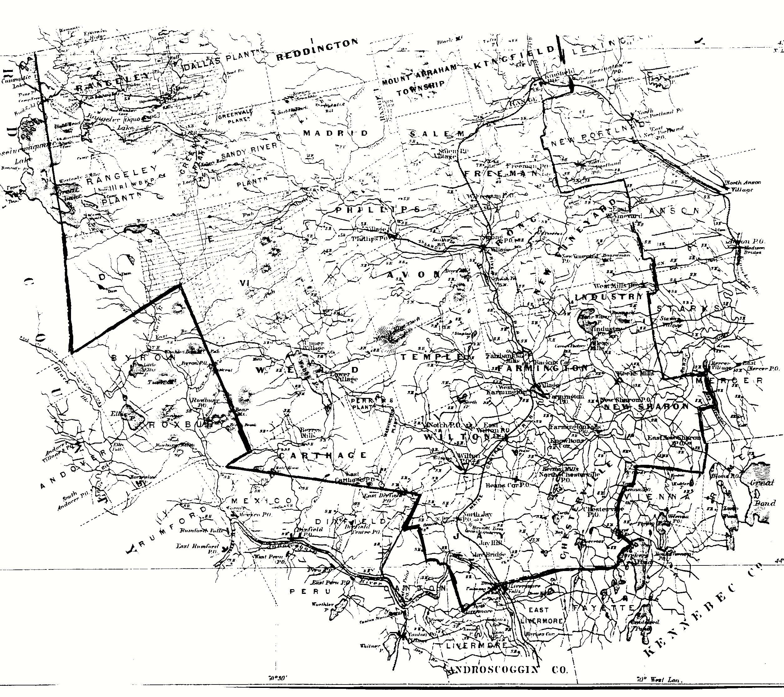
- Franklin County (Part 2)
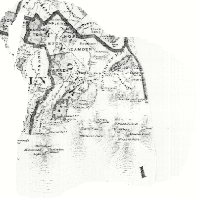
- Knox County
- Lincoln County
Other Maine Maps
- Cemetery Map of Auburn, Androscoggin Co., Maine
- Cemetery Map of Minot, Maine
- Cemetery Map of Livermore Falls, Maine
- Cemetery Map of Livermore, Maine
- Cemetery Map of Poland, Maine
- Cemetery Map of Sabattus, Maine
- Cemetery Map of Wales, Maine
- 1877 Map of Washburn, Aroostook Co., Maine
![]()


This page was first posted
on:
27 May
1999
This page was last updated on -- Saturday, 06-Nov-2021 03:27:54 EDT
![]()
Copyright 1999- USGenWeb Archives Project